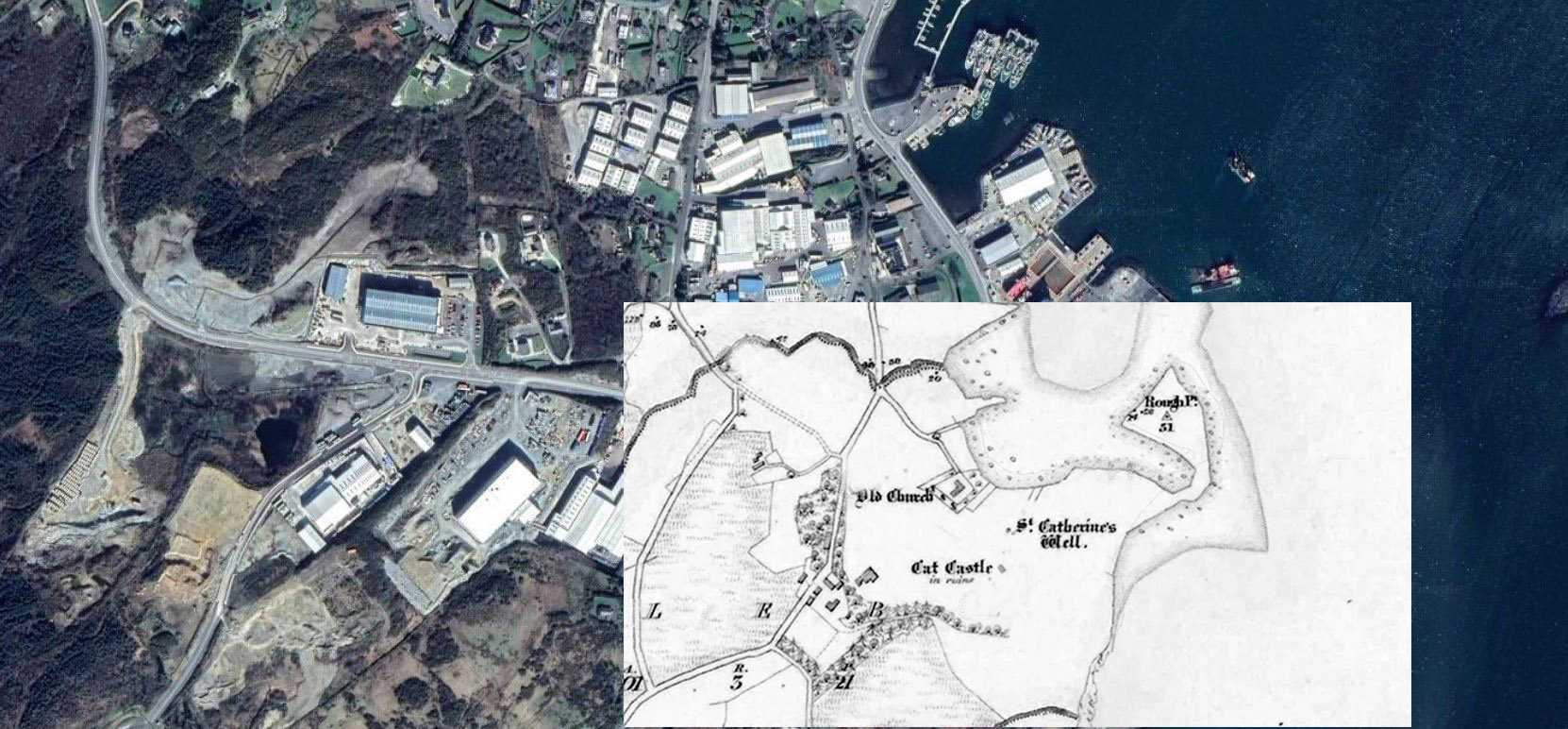
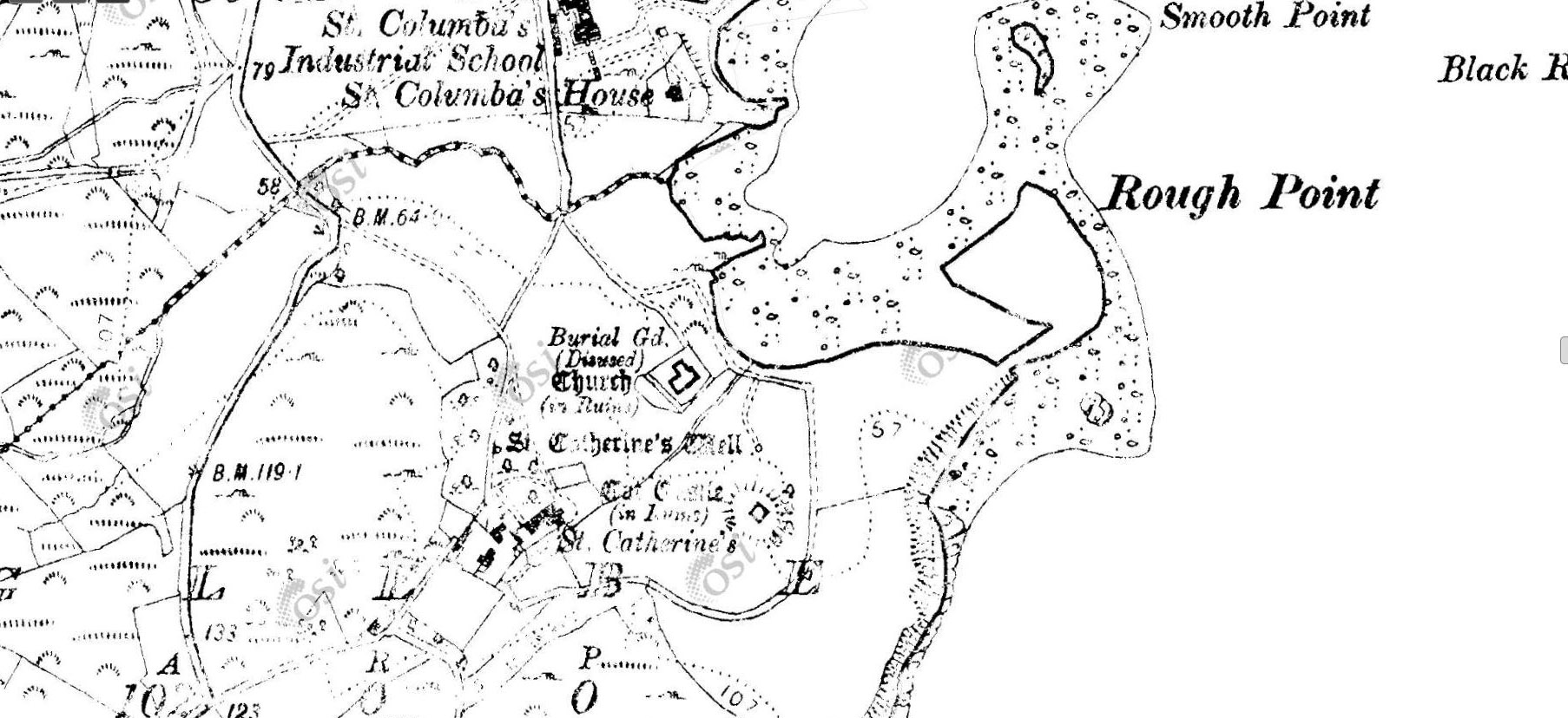
(a) Saint Catherine’s Holy Well
(b) Old Friary Caella Beaga Site and Plantation Church
(c) Saint Catherine’s Rectory
(d) Boundry of Pre-Commonwealth Church Lands
(e) Kit’s ‘Castle’ (Monastic Site & Admiralty Gun Emplacement)

Saint Catherine’s Well is an important site of pilgrimage in the culture of Killybegs. The well receives daily visitors from the town and surrounding area, who journey up the hill and around the site. As a religious icon the site is ingrained in the culture of St. Catherine’s and heritage of the area.


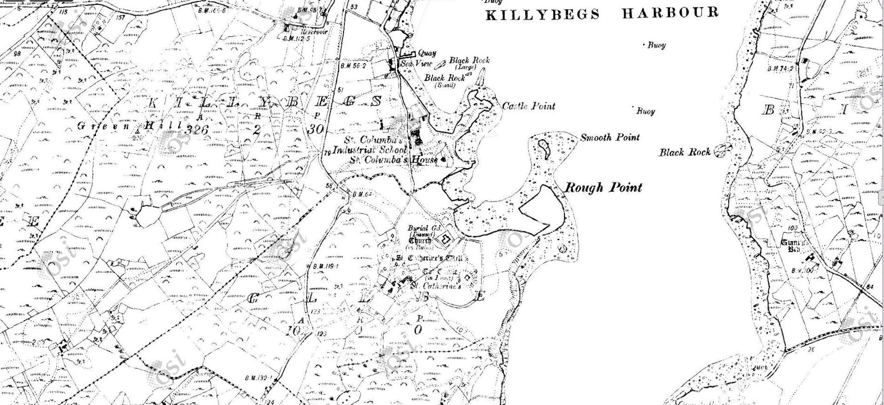
Kit’s castle is probably a corruption of “St Catherine’s Castle”. It is superbly situated on a prominent hill overlooking Killybegs harbour, and is directly above St Catherine’s well.
It was built around 1355 by a native of Killybegs, the then Bishop of Raphoe Padraig McMonagle. Very Little remains of Kit’s Castle except a small wall section showing the stonework and structural location.


Produced by Students at Killybegs LTI Computer Skills and Multimedia


It is import to consider the threats facing heritage sites in the modern world. Many sites are forgotten or lost to the passages of time due to a number of factors.
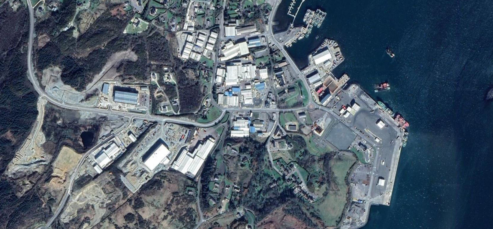
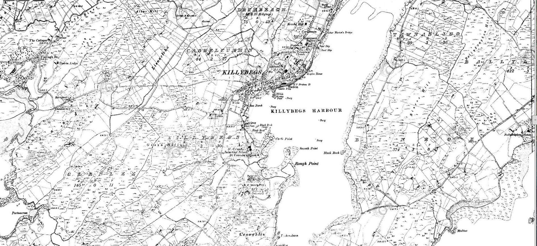
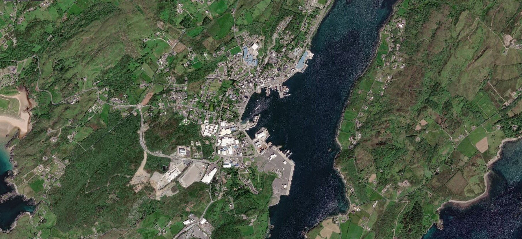
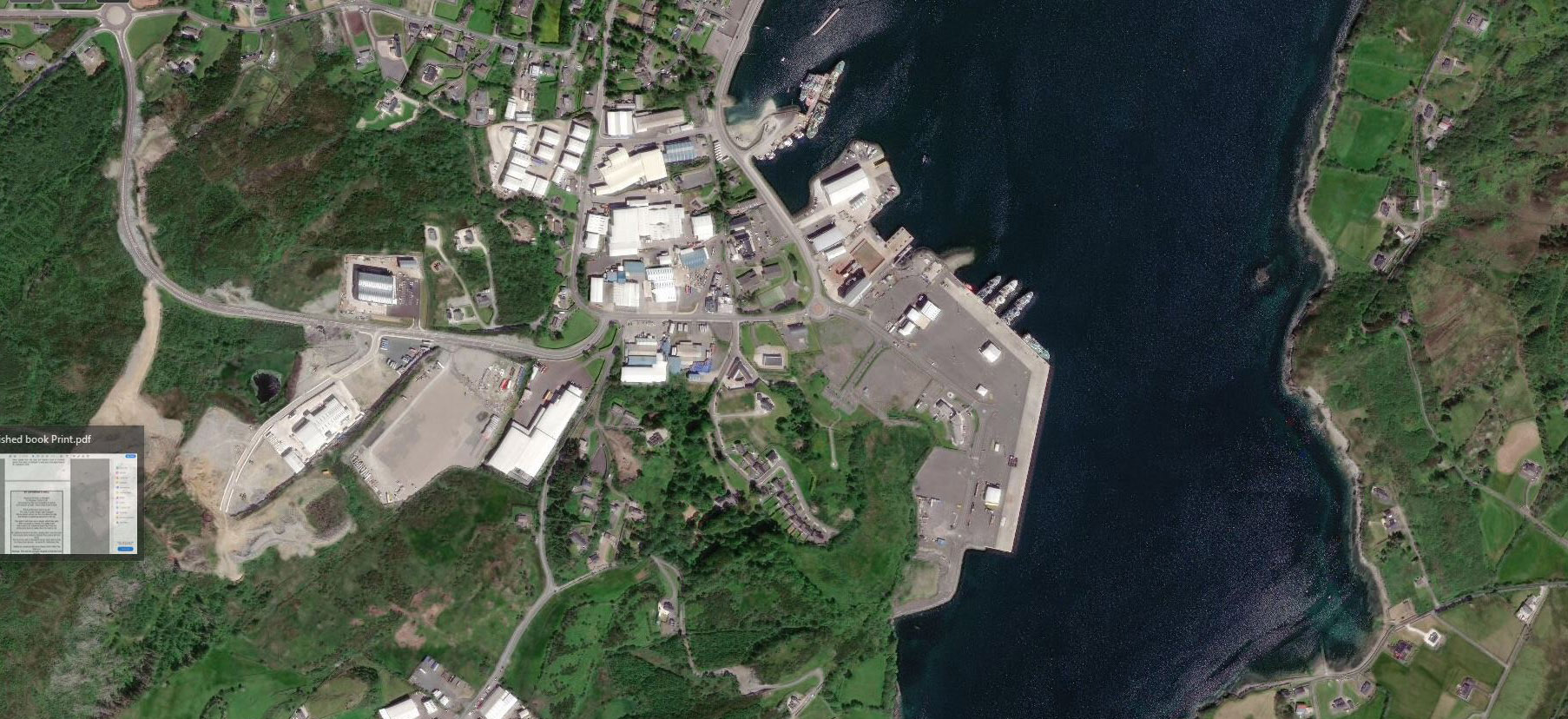
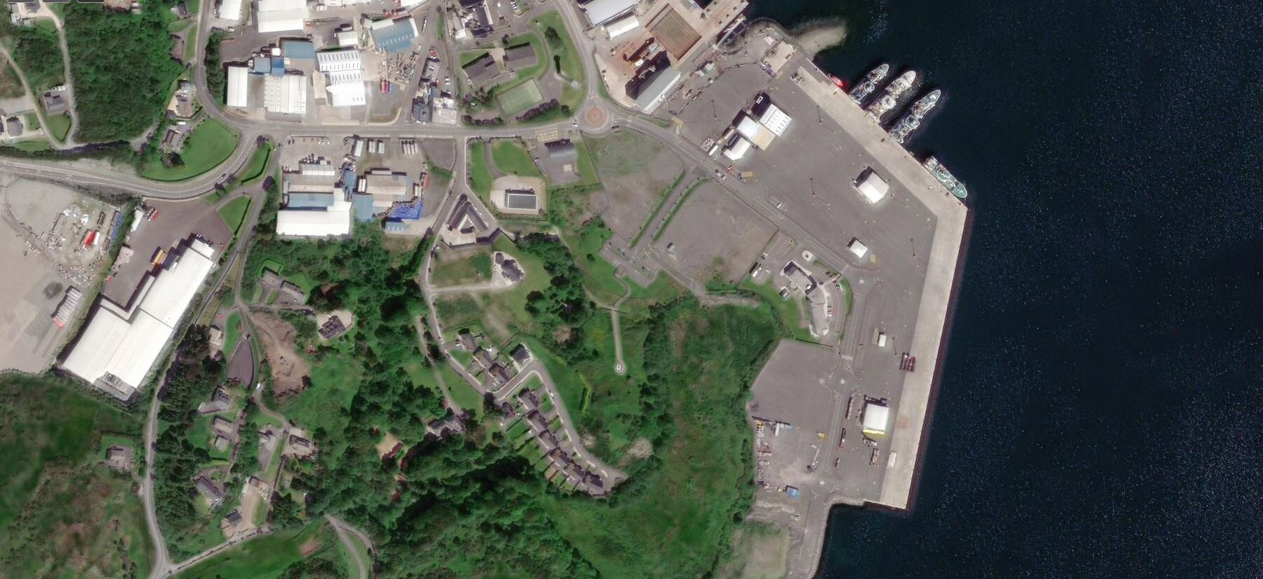
In the case of St. Catherine’s the landscape has changed significantly over the years due to the growth of the modern fishing industry that is located adjacent to the site. Note the change to the water level as the extended harbour area has been built where the bay met the church site.
Ideally, heritage and industry can co-exist with considerate planning and policy at local and national government level.